Measure Modes (Disto/Laser)
Main Menu or Instrument Toolbar | Measure Modes
These are commands built into FieldGenius that will help you measure and map your points while connected to a supported Disto/Laser device. The desired Measure Mode must be selected before you begin a measurement.
For a faster way to get to this screen, you can also press the Measure Modes button which is located on the instrument toolbar.
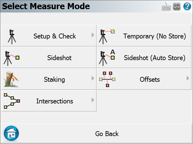
Note: Several of these modes will not be available until you have completed a setup.
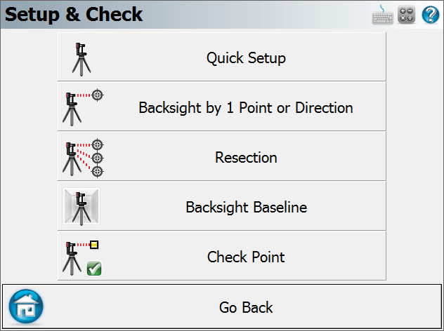
Setup and Check
Quick Setup
Use this to perform a quick setup procedure, with the instrument on a point facing a certain direction. Please see the Quick Setup topic for more information.
Backsight by 1 Point or Direction
Use this to define an instrument setup. Same procedure as with a Total Station, please see the Backsight Method topic for more information.
Resection
This will start the multiple point resection routine to allow you to determine your current instrument position by measuring to known points. Same procedure as with a Total Station, please see the Resection topic for more information.
Backsight Baseline
Use this to define an instrument setup from the position and orientation of an arbitrary baseline. Please see the Backsight Baseline topic for more information.
Check Point
Use this to display a check measurement to an existing point in your Project. Same procedure as with a Total Station, please see the Check Point topic for more information.
Temporary (No Store)
This will allow you to take a measurement without storing it. Same procedure as with a Total Station, please see the Temporary (No Store) topic for more information.
Sideshot
This mode allows you to measure a point. After the measurement, it will allow you to review your measurement data and allow you to make changes to the point ID and description before it is stored. Same procedure as with a Total Station, please see the
Sideshot (Auto Store)
This mode allows you to measure a point using the next available point id, and the description and line toggles specified on the main map screen. Using this is a very fast method for recording your measurements. Same procedure as with a Total Station, please see the
GroupCode
This mode allows you to set up a Group of Codes that have a common theme or purpose, and is ideal to increase productivity for repetitive feature collection. Same procedure as with a Total Station, please see the GroupCode topic for more information.
GroupCode (Auto)
The GroupCode mode with automatic point storing using the next available Point ID.
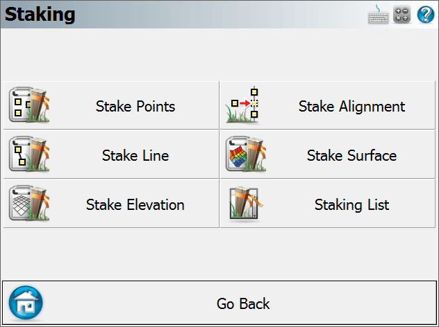
Staking
Please see the
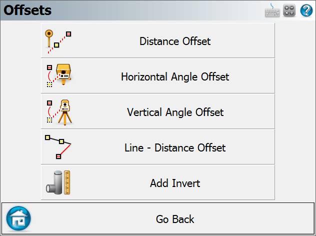
Offsets
Distance Offset
This will start the distance offset routine. Same procedure as with a Total Station, please see the Distance Offset topic for more information.
Horizontal Angle Offset
This will start the angle offset routine. Same procedure as with a Total Station, please see the Horizontal Angle Offset topic for more information.
Vertical Angle Offset
This will allow you to compute the height of an object. Same procedure as with a Total Station, please see the Vertical Angle Offset topic for more information.
Line - Distance Offset
This allows you to measure two points to define a baseline, then manually enter measured distances. These distances will be used to compute a new point based on the baseline. Same procedure as with a Total Station, please see the Line - Distance Offset topic for more information.
Add Invert
Use this to open the invert toolbar. You will then be able to record invert measurements. Same procedure as with a Total Station, please see the Add Invert topic for more information.
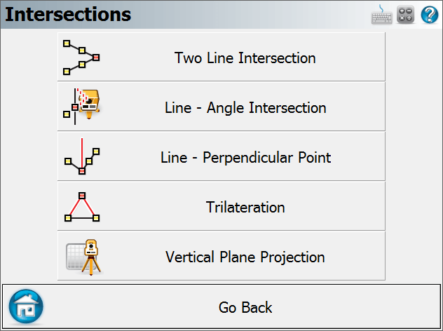
Intersections
Two Line Intersection
This allows you to measure two baselines and FieldGenius will compute the intersection point. Same procedure as with a Total Station, please see the Two Line Intersection topic for more information.
Line - Angle Intersection
This allows you to measure two points to define a baseline, measure an angle, and FieldGenius will compute the intersection point. Same procedure as with a Total Station, please see the Line - Angle Intersection topic for more information.
Line - Perpendicular Point
This allows you to measure two points to define a baseline, then you can select an existing point which will be used to compute a perpendicular intersection. Same procedure as with a Total Station, please see the Line - Perpendicular Point topic for more information.
Trilateration
This will allow you to compute new points by observing their distances from two known existing points. Please see the Trilateration topic for more information.
Vertical Plane Projection
This will allow you to compute points on a user defined vertical plane. Same procedure as with a Total Station, please see the Vertical Plane Projection topic for more information.