EZ SURV
Export from EZ SURV:
- Import Rinex file into EZ SURV
- Post Process (see video linked to here for an overview)
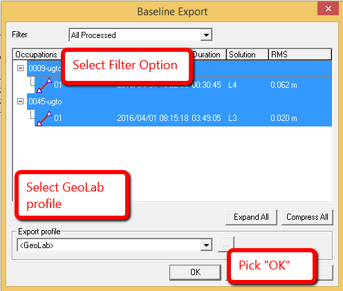
- Tools | Export | Baselines...
- Pick "OK"
- Close EZ SURV and open a STAR*NET Project
Import into STAR*NET:
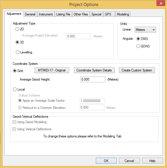
- Set appropriate Project Options such as Coordinate System, 3D or 2D and Project Units:
- Input | Import GPS Data
- Select the "GeoGenius" GPS Data Format
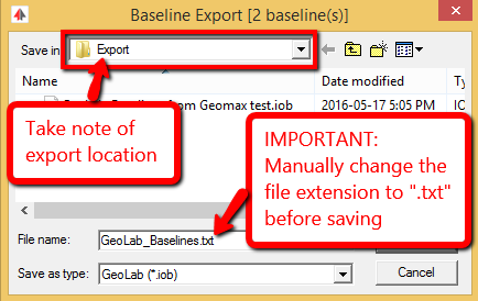
- "Select Input Files" and browse to the text file you exported from EZ SURV
- "IMPORT!"
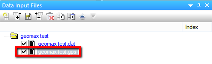
- A new file with the extension ".gps" will be created and added to your project Data Input Files panel:
The process is complete
Notes:
Waypoint: The Waypoint software is an independent suite which processes baselines using raw files from many manufacturer’s receivers. The processed baseline vector files are then stored in files having “EXP” extensions (meaning exported). These are standard text files and each file may contain many vectors. See the Waypoint user’s manual for details on exporting baseline vectors.