Carlson SURV CE, SURV PC or Spectra Precision Fast Survey
Conversion:
Carlson or Spectra Precision Fast Survey (.RW5) files can be imported using the GPS Data Importer.
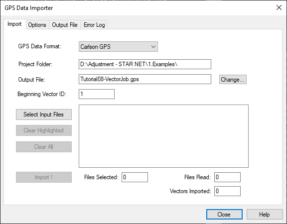
Import Steps:
- Ensure your project is defined as a Grid Proect and that the coordinate system has been selected
- Import Carlson Vectors directly into a STAR*NET project via: Input | Import GPS Vectors | Import
- Select Carlson GPS from the pulldown menu
- Browse to your .rw5 file
- Pick "Import!"
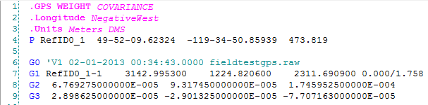
- To see your result double pick on the new ".gps" file that has been added to your Data Input Files panel:
Notes:
Pick here for an article explaining data exchange between MicroSurvey CAD and STAR*NET.
It is important that you are using Carlson SURV CE Version 2.62 or newer for Covariance information to be imported correctly. Pick here for an article explaining the issue.