MicroSurvey FieldGenius
Conversion:
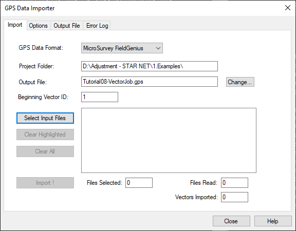
FieldGenius (.RAW) or (.RW5) files can be imported using the GPS Data Importer.
Import Steps:
- Ensure your project is defined as a Grid Proect and that the coordinate system has been selected
- Import FieldGenius vectors directly into a STAR*NET project via: Input | Import GPS Vectors | Import
- Select MicroSurvey FieldGenius from the pulldown menu
- Browse to your .raw file
- Pick "Import!"
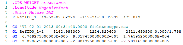
- To see your result double pick on the new ".gps" file that has been added to your Data Input Files panel:
To take full advantage of FieldGenius's linework and extended data collection capabilities when working with MicroSurveyCAD, consider following a "dual import" strategy:
- Run MicroSurvey Transfer to copy your FieldGenius project to the desktop computer
- Use "FieldGenius SyncWizard" to import the points, traverse files, linework, photo notes, GIS attributes and voice notes into a MicroSurveyCAD drawing
- Import the FieldGenius vectors into STAR*NET. Find your Fieldgenius .raw file in the FieldGenius Archive location defined during the MicroSurvey CAD SyncWizard process
- Adjust your network in STAR*NET
- Run MicroSurvey CAD and import the pts file back into MicroSurvey CAD via: MsPoints | Import ASCII. Select the Space Delimited option if you are using the default STAR*NET export type. Points will be updated from the adjusted ascii file and all "Smart" linework will be updated
See this article explaining data exchange between MicroSurvey CAD and STAR*NET.