Offset Measurement
Main Menu or GNSS Toolbar | Measure Modes | Offset Measurement
FieldGenius features a GNSS offset functionality to calculate an offset from the current position based on a direction and distance offsets. The direction may be determined from two observations. This feature is particularly handy when a direct observation is inaccessible or there is too much canopy coverage to get an RTK fixed position.
Function
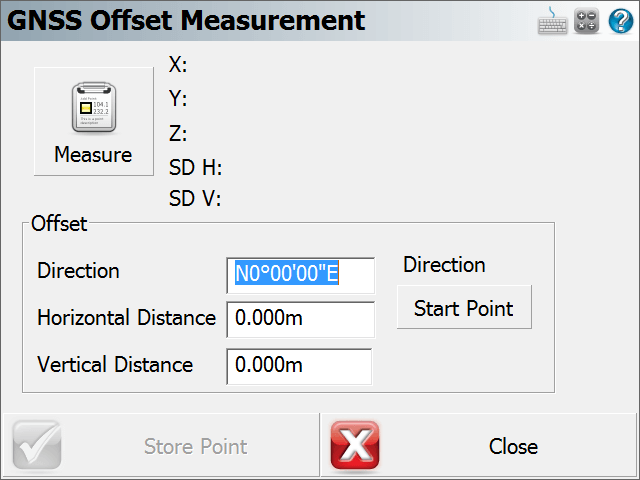
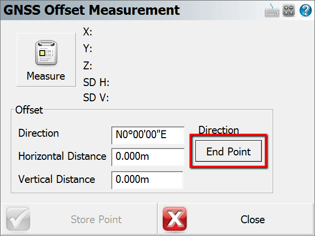
When this mode is enabled FieldGenius the user will press the observation button to start the routine. After this, the GNSS Offset measurement screen as shown below will appear and is ready for the user to press the "Start Point" button to take the first shot. Once that is done the "Start Point" button will change to "End Point". Press this when you are on the second point and ready to take the second observation.
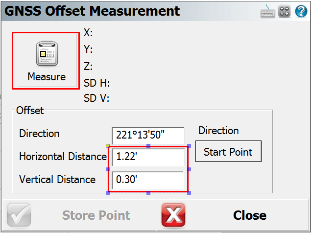
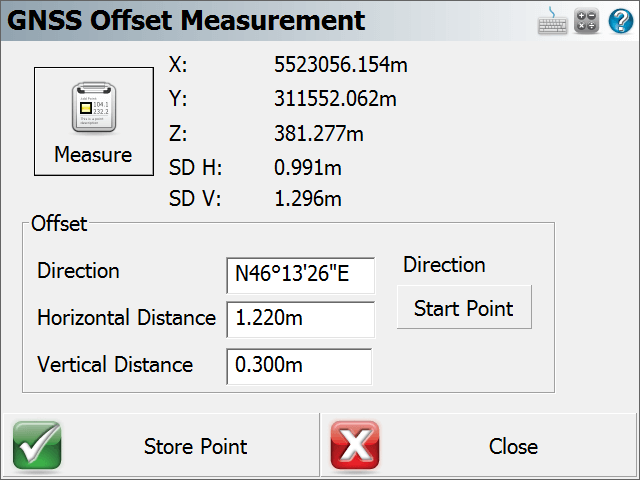
After both Start and End points are observed the Direction field will now be filled with the computed bearing between the two observed points. The next step is to manually enter in the Horizontal and Vertical distances to the new offset point. Fill these fields in and press the "Measure" button to take one more observation that will apply the computed direction, horizontal and vertical distances to the shot and will now populate the Northing, Easting and Elevation fields of the new calculated point in the GNSS Measurement area. The user can now press the "Store Point" button to store the calculated point into the database.

Additional Notes
The user has the option to manually enter in the direction to the offset point if it is already known. A vertical distance is not needed to calculate an offset point, only a Direction and a Horizontal distance are required to complete the routine.