Trilateration
Main Menu or GNSS Toolbar | Measure Modes | Trilateration
This routine allows you to trilaterate the position of new points by observing their distances from two known positions. The two known points will make up a baseline, from which a distance-distance intersection will be calculated to determine the position of each new point.
The primary use of this routine is for GNSS users so they can locate inaccessible points. They can locate two points with GNSS, and then use the Trilateration routine to locate the inaccessible points.
This routine can accept distances measured with the Leica Disto.
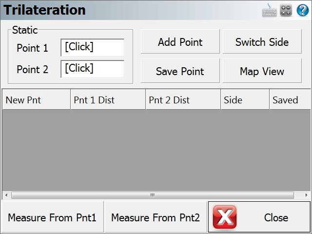
Static Points (Baseline)
Select your two baseline points, from which you will be observing the distances to the new points.
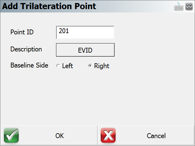
Add Point
Use this to add a new unknown point to solve for. When you press this, you will be prompted for the new point number and description, and whether it is on the left or right side of the baseline.
Save Point
This saves the selected New Point into your project.
Switch Side
This toggles the selected New Point to the Left or Right side of the baseline.
Map View
This takes you to a map view showing your baseline, the distance measured from each point, and the calculated position of the new point.
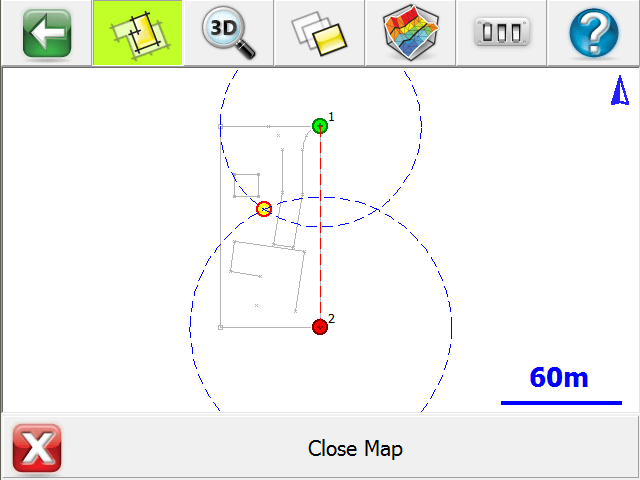
If desired, you can press the World View button on the Display toolbar to hide unnecessary data.
Measure from Point 1
Press this to record the distance from Point 1 of your baseline to the selected New Point.
Measure from Point 2
Press this to record the distance from Point 2 of your baseline to the selected New Point.