Modify Parameters
Main Menu | Survey Tools | GNSS Local Transformation | Modify Parameters
The first step of a transformation is to specify the method to use: None, Similarity or Helmert. Depending on your selection, different input will be required.
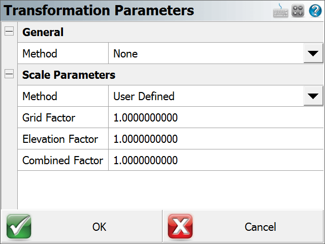
None
For this method, the only input required are the Scale Parameters.
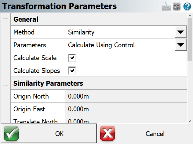
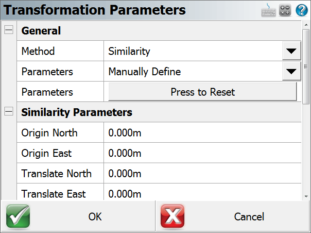
Similarity Method
Similarity transformation parameters can be calculated from control points, or manually defined:
- Calculate Using Control - Requires control points to be measured with GNSS.
- An option exists to Calculate Slopes. This option should only be used if you do not have a geoid model to use for your vertical datum and you need your transformation to align well with the orthometric heights of your local control points. Use this feature with care as it can cause distortions in your elevations if it is used incorrectly.
- An option exists to Calculate Scale. Disabling this option will ensure that no scale is calculated from the control points and the user may want to enter a pre-determined scale in the Scale Parameters section. When this option is enabled, the Scale Parameters should not be manually defined. - Manually Define - Requires previously determined transformation parameter values. The user enters the Origin and Translate Point coordinates, Rotation, Scale Factor, Height Translation and Slopes.
Helmert Method
This method allows the user to manually enter the 7 Parameters of a Helmert Transformation (Translation X, Y and Z, Rotation X, Y, and Z, and Scale). These parameters will usually be pre-computed and/or published.
Scale Parameters
The Scale Parameters can be:
- User Defined - Manually enter the Grid Factor and Elevation Factor to determine the Combined Factor.
- Select From Database - Pick a point from the database that was already measured with GNSS and stored. The Combined Factor of the point will be calculated.
- Measure GNSS Position - Use the current position of the rover to calculate a Combined Factor.
NOTE:
In all cases the entered or calculated Combined Factor will be the inverse of the Combined Factor typically seen published or otherwise calculated.
The standard expression of the typical Combined Factor is:
Grid Distance = Ground Distance * Combined Factor.
We can refer to this as the "Ground to Grid" factor.
FieldGenius expects the "Grid to Ground" Combined Factor, which is the inverse of the typical Combined Factor.
NOTE: The transformation parameters are immediately applied to your current position and written to the Project's *.loc file when you confirm the values with OK.