RTCM: Transformation
Main Menu | Settings | Coordinate System | RTCM: Transformation
FieldGenius supports RTCM Transformation Messages . This routine allows the RTK Network Caster to automatically select the appropriate horizontal coordinate system for the Project location and if needed request a specific Geoid file to be used for the vertical system. This eliminates the coordinate system guess work when using RTK GNSS equipment.
Procedure
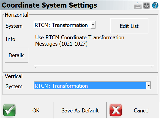
To start the RTCM: Transformation routine the user must go into either the Settings menu from the Main Menu of a current job or when creating a new one, select Project Defaults to bring up the Project Settings dialog to select "Coordinate System." From this screen using the pull down menu for System rather than picking a pre-defined or user defined system we choose "RTCM: Transformation." The user can also select RTCM: Transformation for the Vertical System as well. Press "OK" to continue to confirm the Project settings and continue to connect to the GNSS receiver.

After connection to the GNSS receiver has been achieved FieldGenius will proceed to the Link configure screen. Users will now be asked for the Link Device they wish to use and for the Data Format RTCM 3 must be selected here for the RTCM: Transformation routine to work.
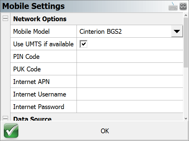
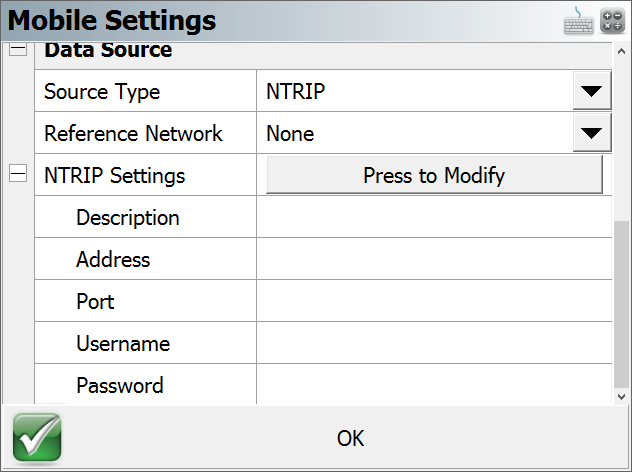
Press the "Setup" button to enter in your GSM SIM card information in the Network Options Section or if you are using Data Collector Internet the Network Options is not required. In both cases the Data Source section will require valid information to be inputted for the connection to work. Click on the "Press to Modify" button to allow you to enter in these parameters. FieldGenius allows multiple NTRIP caster settings to be stored and used.
Verify all information is correct and press "OK" to bring you back to the Link Configure screen and then press the "Connect" button to connect to the caster. It will ask the user to either Request a Sourcetable or select the previously used one. Ensure the selected Sourcetable supports the RTCM 3 transformation message or this process will fail.
- If you are using a Tablet/PC please ensure that the Bluetooth PAN connection is established before attempting to connect to the Caster.
- The Reference Network pull down menu must have something other than the "NONE" option selected. In this example I have chosen the "Nearest" option and the Correction Format is set to RTCM 3.
- Using the Data Collector Internet method is the preferred one for the RTCM Transformation. Using the GSM method may have limited device support.
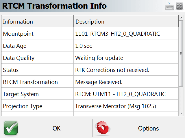
When the connection is complete, the RTCM Transformation Info screen will appear and display the related information for the current Project including the Mount Point used, the status of the RTK corrections and Projection Type. Because the RTCM Messages are not being sent out on the same frequency as the RTK corrections it may take some additional time before they are received. Once they have been received, it will update it to say "Message Received" and provide the Target System and Projection Type.
Note: If you did not receive an RTCM Transformation message the OK button will not active and you need to go into the Options to try a different solution.
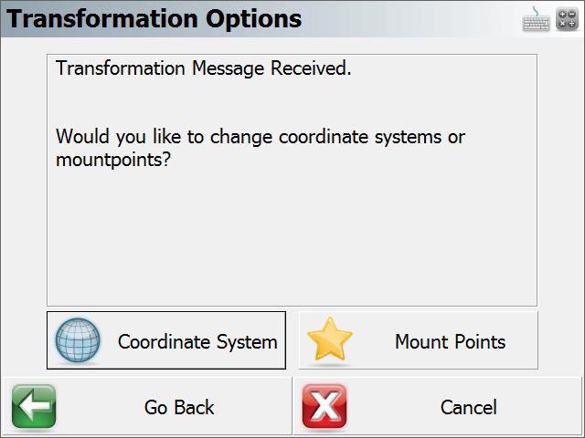
In the Transformation Options screen you will have the following actions.
- Coordinate System - Press this button to abandon the RTCM: Transformation coordinate system and select either a Pre-Defined or a user created Coordinate System.
- Mount Points - Press this button if you want to connect to another Mount Point to continue with the RTCM Transformation.
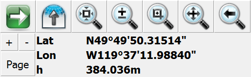
Once in the Map View screen click on the Observation Tool bar to verify you are receiving a valid position.